OpenHikes

A hiking app for iPhone and Apple Watch.

Record your hikes, plan trails on offline maps and open any GPX file — with no account to make and no server holding your hikes. They live on your phone, and follow you between your own devices through your own iCloud.

Free · iPhone with iOS 18.4 or later · Apple Watch app included

Screenshots

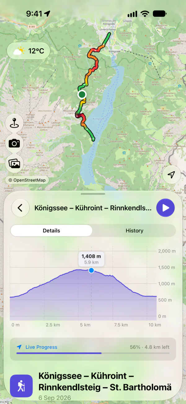
A trail beside a lake on the map, colored by steepness, above its elevation profile and a Live Progress bar saying how much of it is left.
Follow a trail, and see how much is left
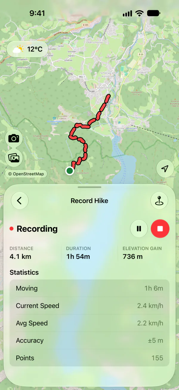
A hike being recorded, with its distance, duration and climb under the line recorded so far.
Record with the phone in your pocket
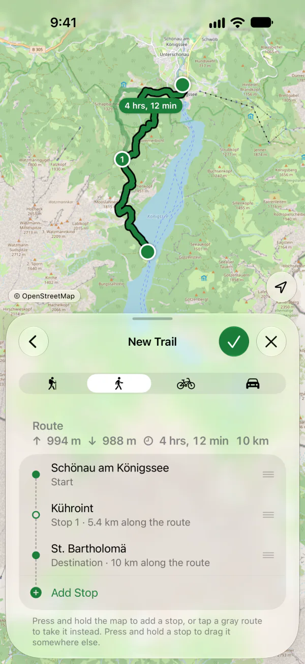
A new trail planned through three stops, routed along paths on the map, with the stops listed underneath.
Plan a trail stop by stop
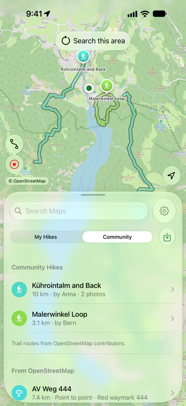
Hikes other people published and a waymarked route from OpenStreetMap, listed under the map with their lines drawn on it.
Find trails other hikers published
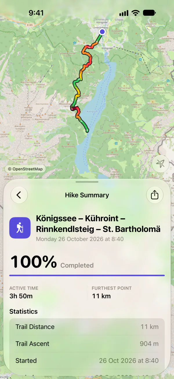
The summary of a walk that covered the whole trail, with its active time and furthest point.
Look back on every walk

What it does

Record your hike

Tap record and put the phone in your pocket. OpenHikes keeps the track with the screen off and fuses the barometer into the elevation, so the climb is the climb. A recording survives the app being closed. Siri and Shortcuts can start, pause and stop it, and Control Center can start and stop it.

Plan a trail

Put stops on the map and each leg is routed along real paths, so the length is the length of the walk. Reorder the stops like directions in Apple Maps, then save the trail and hike it.

Maps that work with no signal

OpenStreetMap is the default, and free. Areas you browse are kept automatically, so the map you looked at last night is still there in the valley with no bars. Color the route by steepness or by difficulty.

Bring the GPX you already have

A .gpx file from Files, AirDrop, Mail or any share sheet opens straight into the app, with its statistics and an elevation profile you can scrub. Share a hike and you get a standard GPX file back, so nothing is locked in.

Places along the trail

Viewpoints, summits, water, shelters, camps and parking along your trail, from OpenStreetMap. Attach your photos to them, or mark places of your own.

Photos where you took them

Pictures from the hike are pinned to the point on the trail where they were taken, found by their timestamps or picked from your library. Share a hike as a picture: its line and figures over one of your own photos.

Trails other people have hiked

Pan the map and ask, or search by name, for hikes other people have published and the waymarked routes OpenStreetMap knows about. Publishing your own is free, and a person reviews every hike before anyone else sees it.

On your Lock Screen and Home Screen

A widget draws your trail with its progress. While you record or follow a trail, a Live Activity keeps the figures on the Lock Screen and in the Dynamic Island.

Weather, Health and iCloud

Apple Weather sits over the map. Finished hikes can be saved to Health as workouts, and your hikes follow you to your other devices through your own iCloud.


On your wrist

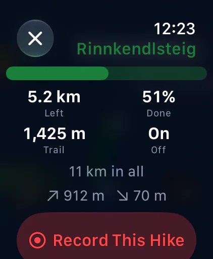
The Apple Watch app draws the trail you picked and shows where you are on it and how much is left. It works that out on the watch itself, so it keeps going with your phone in your bag.

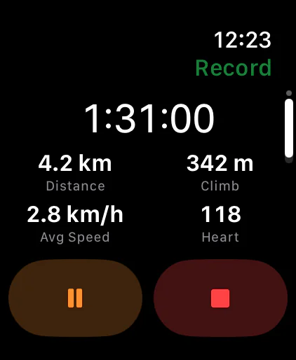
It records a hike on its own, through a long walk with the screen dark, and hands the finished walk to your phone the next time the two are together. While your phone is the one recording, the watch can pause, resume and stop it.

The watch app comes with the iPhone app and needs watchOS 11 or later.

Apple Watch following a trail, with the distance left, the share done and whether you are on the trail. Apple Watch recording a hike, with its time, distance, climb, average speed and heart rate.

Your hikes stay yours

There is no OpenHikes account and no server holding your hikes. They sync through your own private iCloud, while photographs and saved maps stay on the device they came from. The app contains no analytics, no advertising and no tracking of any kind.

Nothing you record reaches other people unless you publish it. The Privacy Policy describes exactly what the app sends, and where.

Free, with an optional Pro

Recording, the OpenStreetMap map, GPX, photos, community trails, the widget, the Live Activity, the Apple Watch app and iCloud sync are all free.

OpenHikes Pro is a monthly subscription with a free trial. It adds commercial map styles with hillshading and contour lines, a whole route’s map downloaded before you leave, and elevation for trails that have none. Those services bill OpenHikes for every use, and paying for them is what keeps the free map free.

Open source

OpenHikes is made by one person and is open source under the MIT license. If you would rather know what it does than take a policy’s word for it, the whole app is on GitHub, along with what is being worked on next.

Something broken, unclear or missing? The support page says how to get in touch, and answers the common questions.